Outcomes of the reassessment of local roads
Please be aware this information relates to an old consultation and is therefore now out of date.
For the latest information on 20mph, please click here.
Latest information on 20mph
Over the last 12 months, Flintshire County Council has been gathering the views of local residents to help inform a review and understand concerns about specific roads. As a result of this feedback, the Council has reassessed a number of roads in Buckley and its surrounding areas.
Using the exception criteria published by the Welsh Government in November 2022, nine local roads have been identified as containing stretches which meet the exceptions to 20mph speed limit restrictions or require a further assessment outside of the 20mph change in legislation process. These roads will now be subject to a statutory consultation period scheduled for July/August, pending the outcome of which, reassessed limits will be introduced in November.
A full list of the roads identified and the location of the exceptions, can be found below
Exceptions
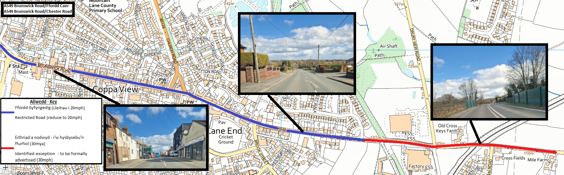 Open A549 Chester Road in new window
This map shows the locations on A549 Chester Road that have been identified as a restricted road (to remain at 20mph) or an identified exception - to be formally advertised (30mph)
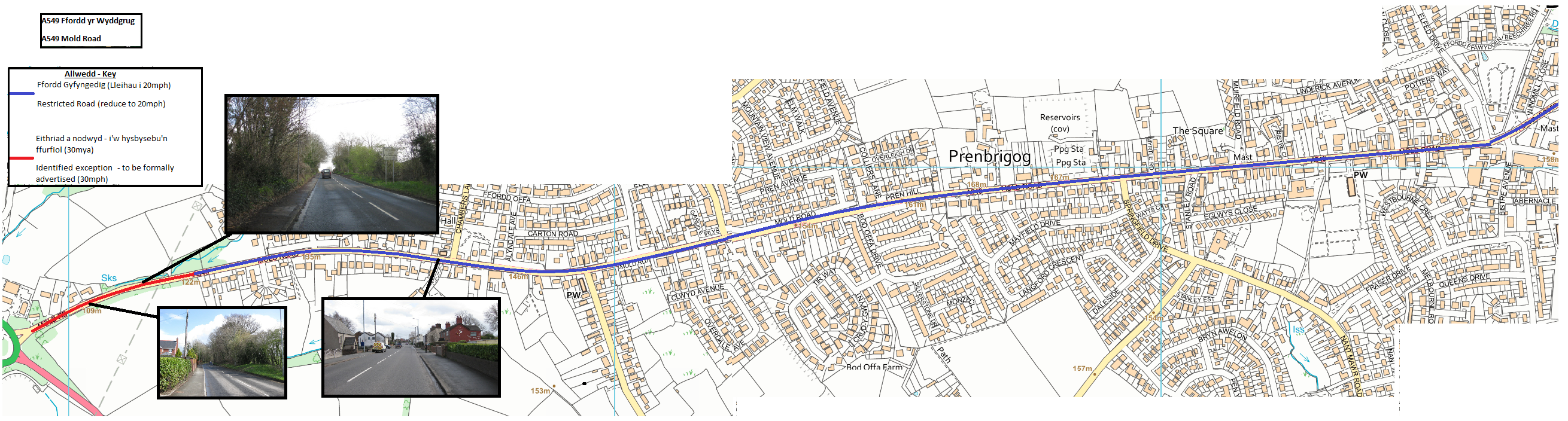 Open A549 Mold Road in new window
This map shows the locations on A549 Mold Road that have been identified as a restricted road (to remain at 20mph) or an identified exception - to be formally advertised (30mph)
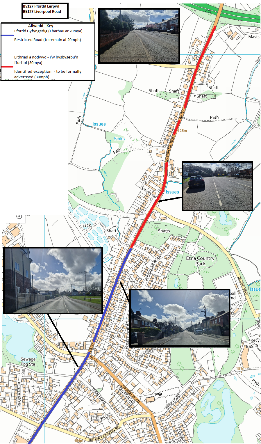 Open B5127 Liverpool Road in new window
This map shows the locations on B5127 Liverpool Road that have been identified as a restricted road (to remain at 20mph) or an identified exception - to be formally advertised (30mph)
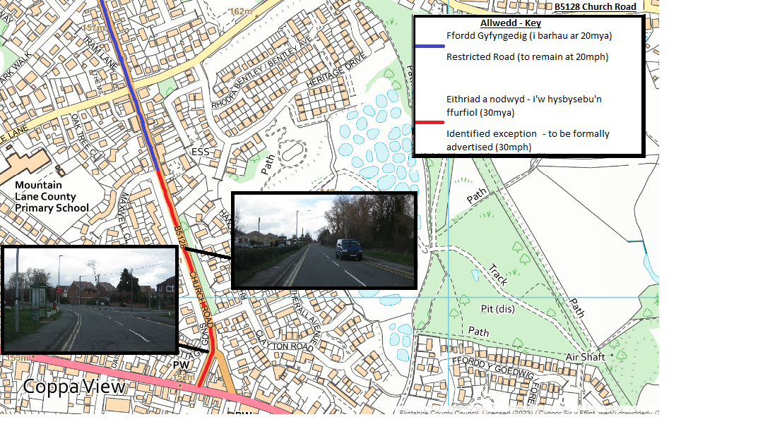 Open B5128 Church Road in new window
This map shows the locations on B5128 Church Road that have been identified as a restricted road (to remain at 20mph) or an identified exception - to be formally advertised (30mph)
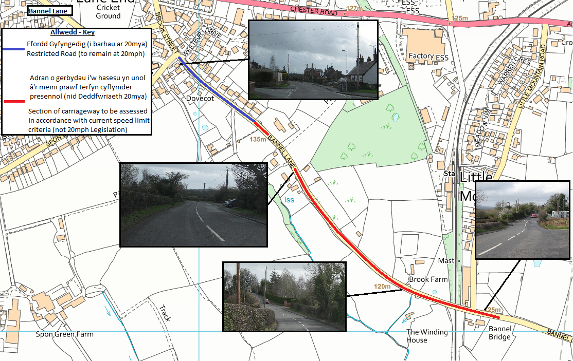 Open Bannel Lane in new window
This map shows the locations on Bannel Lane that have been identified as a restricted road (to remain at 20mph) or a section of carriageway to be assessed in accordance with current speed limit criteria (not 20mph legislation)
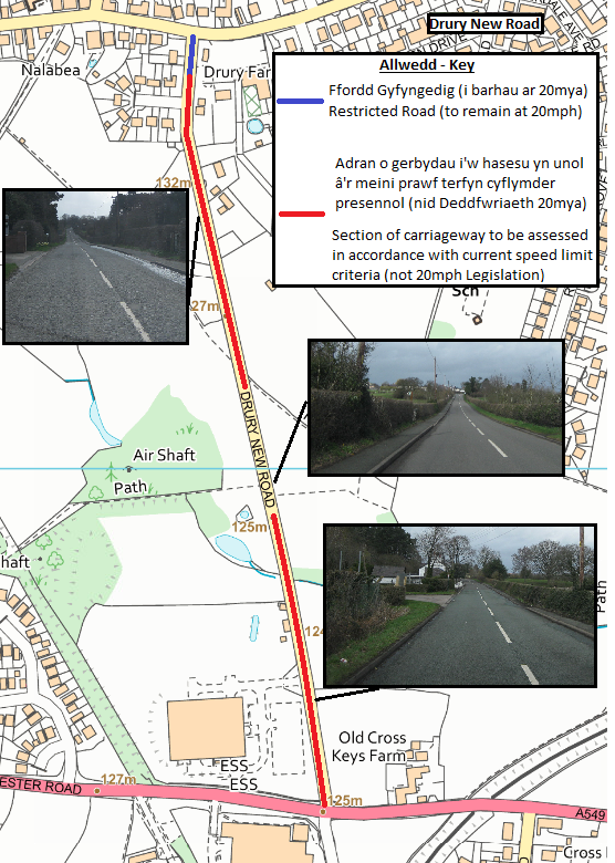 Open Drury New Road in new window
This map shows the locations on Drury New Road that have been identified as a restricted road (to remain at 20mph) or a section of carriageway to be assessed in accordance with current speed limit criteria (not 20mph legislation)
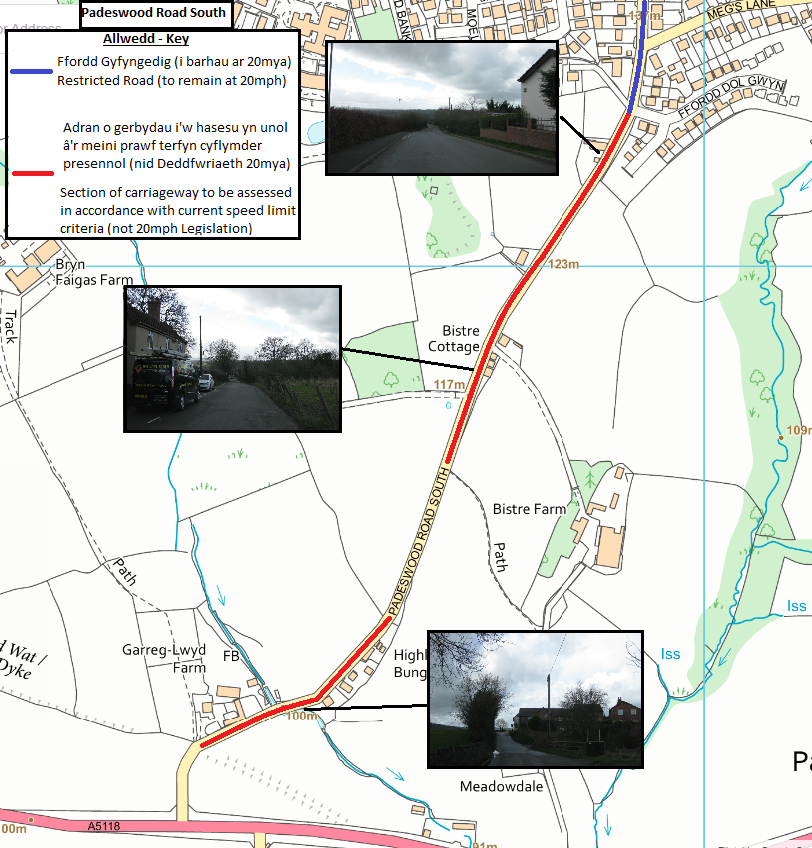 Open Padeswood Road South in new window
This map shows the locations on Padeswood Road South that have been identified as a restricted road (to remain at 20mph) or a section of carriageway to be assessed in accordance with current speed limit criteria (not 20mph legislation)
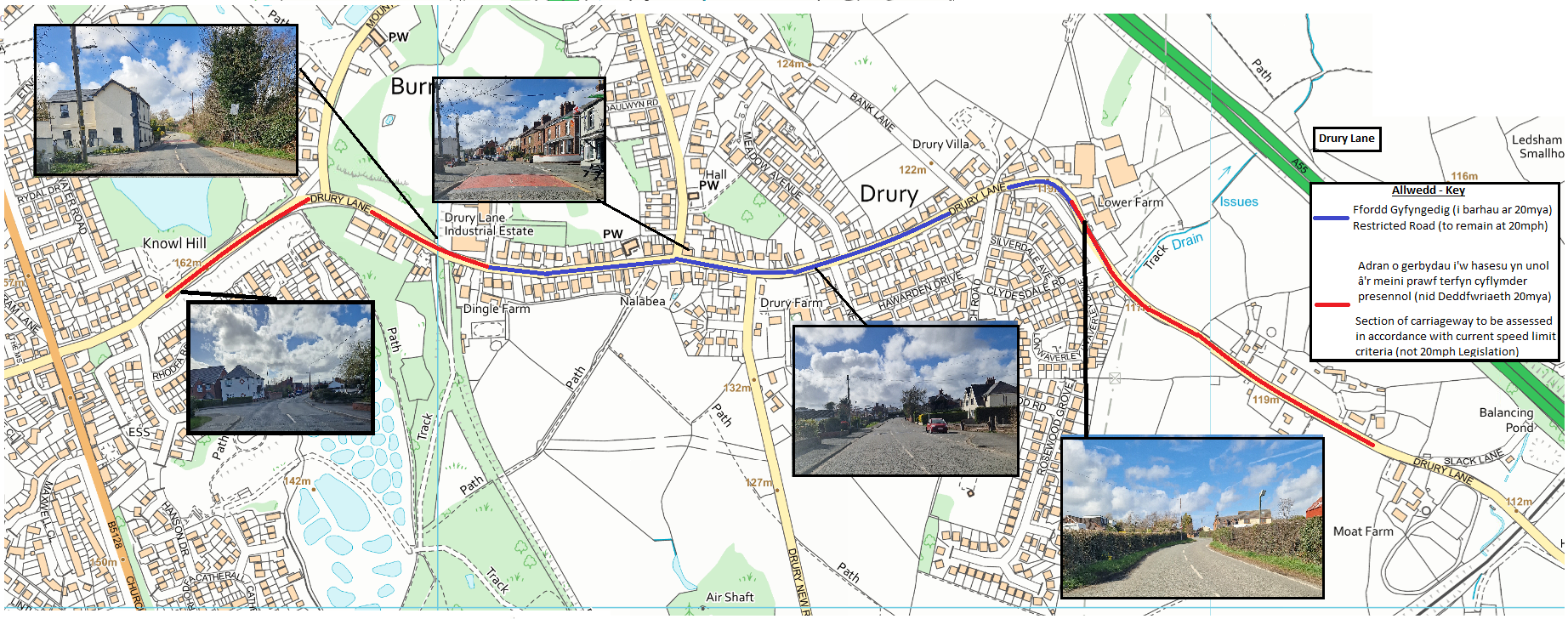 Open Drury Lane in new window
This map shows the locations on Drury Lane that have been identified as a restricted road (to remain at 20mph) or a section of carriageway to be assessed in accordance with current speed limit criteria (not 20mph legislation)
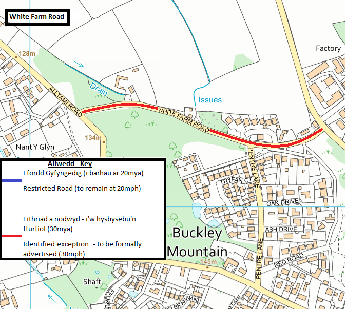 Open White Farm Road in new window
This map shows the locations on White Farm Road that have been identified as a restricted road (to remain at 20mph) or an identified exception - to be formally advertised (30mph)